Townland Names
Below is a short description of what Townlands are. However, the recording of townlands in Glenshesk are part of a larger and ongoing project which you can contribute too. Read on, to learn more
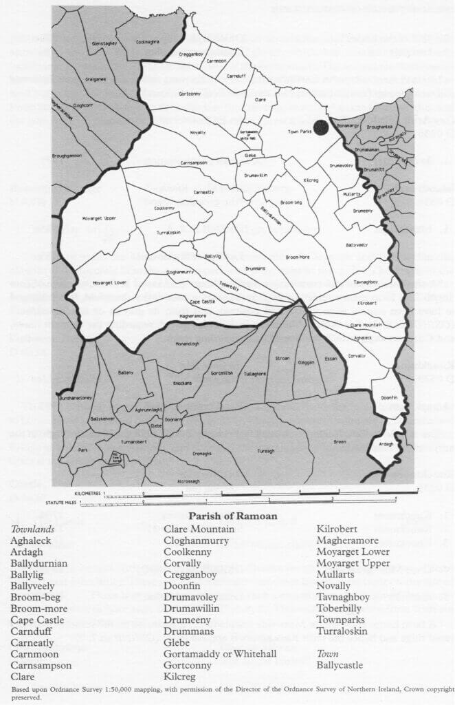
Townlands in Glenshesk:
Every inch of the Glen is in a townland, and although some names have been lost over the generations, many are still with us today, as farms and fields still bear their name. Until the 1970’s they were in common use as an address for the locals, but sadly at this time the Post Office as it was then, discouraged the use of them, preferring people to use postcodes instead which were thought to be more accurate. However in reality, most families were known by their townland, and the local postmen knew them too.
As the late well-known historian Cathal Dallet stated in an article titled “Townlands – Their origin and significance, The Glynns V18, 1990”, “In family history or genealogy research, you may consider yourself very lucky if you know the Parish from which your ancestors came. But so often you come across several of the same name in one Parish. Here the townland may be your only source of identification. Take a North Antrim name like McCaughan- there are many families of this name and the only way I can separate them is by their townland names. So if you know the townland from which your ancestors came you are doubly fortunate.”
In relation to the origin of townlands, It should be remembered that many of these are ancient and unique and have a direct connection to the land and people who worked there. The translation and spelling is hard to pin down for some of them, as many have been lost over the centuries, but they are very much part of our own DNA and of who we are. They need to be recorded before they are lost in time. If you know of any townland names in Glenshesk not recorded below, then please contact us through the Contact tab on this webpage.
Here are some of the main townlands and other names in and around Glenshesk:
Aghaleck – Achadh Leice, “field of the flagstone”
Altiffiran Glen – “Iffernan’s or Heiferanans Glen”
Ardagh – Ardach , “the high field”
Ardaghmore or Glentop – Ardach Mor, “high field, big”
Ballypatrick- Baile Phadraig, “St Patrick’s townland”
Bonamargy- Bun na mairgeagh, “The foot of the market”
Ballyveely – “the townland of blood or slaughter”
Brackney – Breacnaigh , “speckled place or place trout”
Broughmore – An Bruach Mor , “The Great Bank/enclosure”
Churchfield – Machaire an Teampaill, “plain of the church”
Clare – clár, “the plain/level place”
Corvally – An Corrbhaile, “the prominent townland”
Craigban – Craig van, White Rock
Coolaveely – “the corner/recess of blood or slaughter, or the corner of the ancient pagan tree”
Doonfin – Dún Finn, “Fionn’s Fort”
Drumacullin- Druim an cuilinn, “The hill ridge of the holly tree”
Drumeeny – Droim Fhinnigh, “Finneach’s ridge”
Drumahanan – Droim an chamain, “ridge of the small river-bend”
Drumahitt – Droim an Chait, “ridge of the cat”
Drumavoley – Druim an bhuaile, “the hill ridge of the booleying”
Duncarbit – Dún Carbaid, Dun cearbaid, “The Fort of the Chariot”
Glenmakeeran – Gleann nai Caorthainn, “Valley of the field of rowan”
Greenans – Grianán , “the sun palace” or “The eminent place”
Kilrobert – Cill Roibeaird, “Robert’s burial ground”
Knocklayde – “the broad mountain”
Loughan – An Lochan, “the pond”
Mullarts – Maolaird, “bare hillock”
Tavnaghboy – Tamhnach Bhui, “yellow field”
Tenaghs – Teangach, “Place of the tongues of land”
_____________________________________________________
Other interesting ancient names and and around Glenshesk include:
Coskemnacally – Ucht Briste Cri, “Fractured mountain breast of the boundary”
Glemakeerin – Gleann Mai Caorthainn, “valley of the field of rowan”
Killuca Burn – cill “church, burial ground” or “Luke burial ground”
Slaght – An Sleacgt, “the grave”
Owencam River – An Abhainn Cham, “the twisting river”
• Glenshesk – Gleann Seisce/Seisc, the sedgy glen or in Irish, Gleann Seisc (glan shesk) “barren glen/valley”
We are always on the lookout to record more of the Townland as well as the field names around Glenshesk, but if you know of any then please email [email protected] . More will be added to this list, whenever we have the time to do so!
A great resource for tracking down the townland names is the first link which is worth exploring.
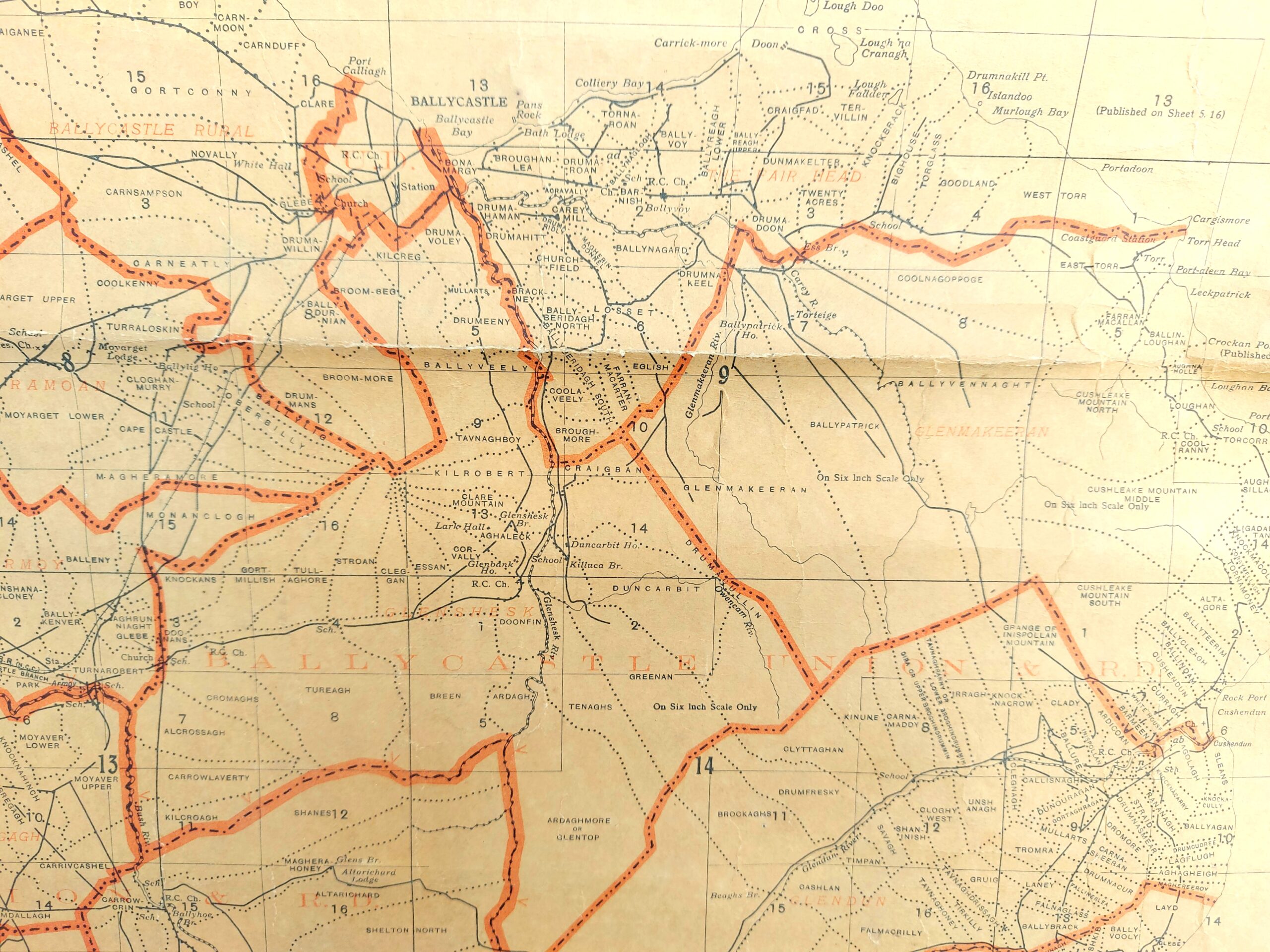
Separately, the second link to “Historical Maps” is excellent. It takes you to a brilliant website which has all the Ordnance Survey maps over many decades. The 1905 map in particular is the best one to look at. Click on the second logo from the right of the group of logos, to the top right of the Page to examine different maps.
The third Link, Placenames and Fieldnames of Culfeightrin” is an excellent publication by the Carey Historical Society and includes part of Glenshesk
OS N.Ireland Map, showing Glenshesk and surrounding area, 1943
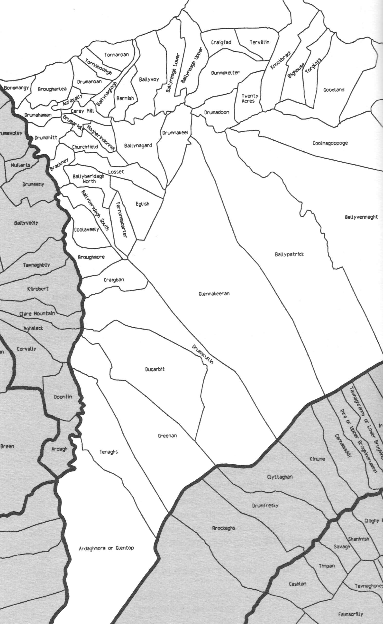
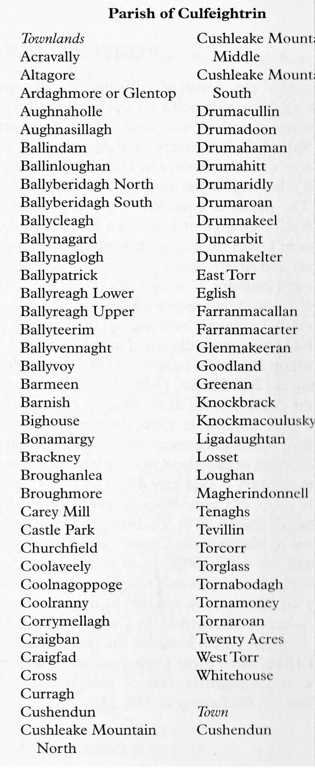
Parish of Culfeightrin Townland names which at one time included one half of Glenshesk, with kind permission of Institute of Irish Studies, Queen’s University of Belfast, and Ordanance Survey NI, 1